Residents across Montclair and surrounding communities in Essex County are being urged to remain weather-aware as strong thunderstorms move through northern New Jersey, bringing the potential for damaging winds, large hail, heavy rainfall, and isolated tornadoes. Meteorologists continue to monitor changing atmospheric conditions that could allow severe storms to develop rapidly throughout the day.
While no confirmed tornado has been reported in Montclair, emergency management officials are encouraging residents to stay informed and be prepared to take shelter if a tornado warning is issued. Summer storms in New Jersey can strengthen quickly, leaving little time to react once dangerous weather develops.
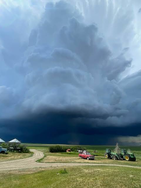
Severe Weather Threat Across Northern New Jersey
Forecasters say warm, humid air interacting with an approaching weather system has created favorable conditions for severe thunderstorms across portions of northern New Jersey. These storms may produce:
-
Damaging wind gusts capable of downing trees and power lines.
-
Torrential rainfall that could lead to localized flash flooding.
-
Frequent cloud-to-ground lightning.
-
Large hail.
-
Isolated tornadoes in the strongest rotating storms.
Communities including Montclair, Bloomfield, Glen Ridge, Verona, West Orange, Cedar Grove, and neighboring municipalities are being advised to closely monitor weather updates as storms move through the region.
Tornado Watch vs. Tornado Warning
Emergency officials remind residents that there is an important distinction between a tornado watch and a tornado warning.
A tornado watch means atmospheric conditions are favorable for tornado development, and residents should remain alert and have a safety plan in place.
A tornado warning means a tornado has either been detected by weather radar or observed by trained weather spotters. When a warning is issued, people in the affected area should seek shelter immediately.
Because severe weather can intensify with little warning, officials recommend monitoring multiple reliable weather sources throughout the day.
Storms May Cause Power Outages and Travel Delays
Strong thunderstorms have the potential to create hazardous conditions across Essex County and surrounding areas.
Possible impacts include:
-
Downed trees and tree limbs.
-
Scattered power outages.
-
Flooded roadways.
-
Reduced visibility due to heavy rain.
-
Traffic delays caused by storm damage or emergency response activity.
Drivers are encouraged to slow down during heavy rain, avoid flooded roads, and never drive through standing water, as water depth can be difficult to judge.
How to Prepare if a Warning Is Issued
Emergency management officials recommend reviewing severe weather safety plans before storms arrive.
If a tornado warning is issued:
-
Move immediately to a basement if one is available.
-
If no basement exists, seek shelter in an interior room on the lowest floor of a sturdy building.
-
Stay away from windows, doors, and exterior walls.
-
Keep a charged cellphone, flashlight, and emergency supplies nearby.
-
Continue monitoring official weather alerts until the warning expires.
Residents living in manufactured or mobile homes should relocate to a more substantial shelter if time permits, as these structures provide significantly less protection during tornadoes.
Stay Informed Through Official Sources
Authorities encourage residents to rely on trusted weather information rather than rumors circulating on social media.
Useful sources include:
-
National Weather Service alerts.
-
NOAA Weather Radio.
-
Local television meteorologists.
-
Official county emergency management notifications.
-
Wireless Emergency Alerts sent to mobile devices.
Having multiple methods of receiving warnings can provide valuable extra minutes to seek shelter during rapidly changing weather conditions.
Situation Continues to Be Monitored
As of the latest available information, no active tornado warning has been issued specifically for Montclair or Essex County. However, severe thunderstorm activity remains possible across northern New Jersey, and weather conditions can change quickly.
Meteorologists will continue monitoring storm development throughout the day and evening, issuing additional watches or warnings if necessary.
Residents are encouraged to remain vigilant, review their emergency plans, and stay informed as severe weather moves across the region.