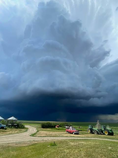
Residents across Abilene, Texas, and surrounding communities are being urged to remain weather-aware as severe thunderstorms capable of producing tornadoes, giant hail, damaging winds, and flash flooding move across West Texas.
The National Weather Service has issued tornado warnings and other severe weather alerts for portions of the Big Country as rotating thunderstorms continue to develop. Forecasters warn that conditions may change rapidly, with some storms capable of producing dangerous tornadoes with little advance notice.
Tornado Warning Issued for the Abilene Area
Meteorologists began issuing emergency weather alerts as powerful thunderstorms intensified across West Texas, creating an environment favorable for severe weather.
The strongest storms are capable of producing:
-
Tornadoes
-
Large to giant hail
-
Damaging straight-line wind gusts
-
Frequent cloud-to-ground lightning
-
Heavy rainfall that may trigger localized flash flooding
Weather officials say rotating supercell thunderstorms remain the primary concern, as these storms have the greatest potential to produce tornadoes and destructive hail.
Residents are encouraged to closely monitor forecasts and be prepared to seek shelter immediately if warnings are issued for their specific location.
Dangerous Storms Continue Moving Across West Texas
Emergency management officials and meteorologists continue tracking storm development throughout the Big Country region.
The evolving weather system has prompted increased monitoring as storms move through Abilene and neighboring communities. While not every thunderstorm will produce a tornado, forecasters caution that any storm exhibiting strong rotation could quickly become dangerous.
Authorities are also monitoring rainfall rates, as heavy downpours may lead to localized flooding in low-lying and poor-drainage areas.
Potential Impacts Across the Region
Severe thunderstorms could create hazardous conditions across much of the Abilene area.
Potential impacts include:
-
Downed trees and utility poles
-
Power outages caused by strong winds
-
Roof, vehicle, and property damage from large hail
-
Dangerous travel conditions during heavy rain
-
Localized flash flooding
-
Debris becoming airborne during severe wind events
Motorists are urged to avoid driving through flooded roadways and to exercise caution if traveling while storms are active.
Safety Officials Urge Residents to Prepare
Emergency officials are reminding residents to take severe weather warnings seriously and have a safety plan in place before storms arrive.
Officials recommend:
-
Monitoring weather alerts from trusted sources, including the National Weather Service
-
Moving immediately to a sturdy building if a tornado warning is issued
-
Taking shelter in an interior room on the lowest floor, away from windows
-
Keeping mobile phones and emergency devices fully charged
-
Avoiding unnecessary travel until severe weather has passed
-
Having multiple ways to receive emergency weather notifications
Weather conditions can change rapidly, particularly during supercell thunderstorms capable of producing tornadoes.
Meteorologists Continue Monitoring Storm Development
Forecasters continue to monitor the evolving storm system as it tracks across West Texas.
Additional tornado warnings, severe thunderstorm warnings, or flash flood advisories may be issued depending on how storms develop throughout the day and evening. Residents are encouraged to remain alert until the severe weather threat has completely ended.
Stay Weather Aware
The ongoing severe weather threat underscores the importance of remaining prepared during tornado season in Texas. Although not every warning results in a tornado, officials emphasize that taking shelter promptly can save lives when dangerous storms develop.
Residents in Abilene and surrounding West Texas communities should continue following official weather updates and be prepared to act quickly if additional warnings are issued as the storms move through the region.